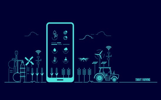
The concept of precision farming is being successfully developed and implemented by a growing number of farmers who want to save time, use resources efficiently and increase the productivity of their fields. It is worth noting that the development of the concept of precision agriculture would hardly have been possible without satellite images.
It is impossible to refuse scouting activities completely, but satellite imagery remotely provides a bird’s eye view of the fields. With the help of satellite imagery, farmers can detect various changes in their fields and monitor the crops using NDVI and other indices. Satellite imagery data is helping farmers make more informed and efficient decisions about fertilizer use and which parts of their fields to inspect.
Today, the use of satellite image and GPS technology dramatically expands the capabilities of agronomists, farm managers, and agricultural researchers. These technologies provide data on the state of crops throughout the growing season, also allowing remote monitoring of evapotranspiration levels, soil moisture, and irrigation.
7 Best Free Satellite Image Sources
EOS LandViewer is a GIS tool that enables quick search and on-the-fly processing of satellite imagery. This tool provides users free mid-resolution imagery and paid high-resolution imagery. The server finds relevant images according to the area of interest highlighted by the user.
After finding the necessary images, users can apply different spectral indices to them for analysis and receive the necessary processed data. The ability to do this in one place saves time and memory. Upon completion of processing, images can be downloaded for free in a suitable format or kept in cloud storage until the user needs them. EOS LandViewer can be integrated into other software as it’s compatible with 3d party tools to give users the opportunity to get more valuable information from satellite imagery.
Sentinel Hub provides satellite data from all over the world. Pictures are updated once a week. In addition, the server provides access to archived data and free SAR data. Working with this platform can be difficult for beginners. However, users with experience in geospatial analysis will be able to reap many benefits, including the use of various advanced image processing tools.
On Google Earth, users can access Landsat-8 satellite images for free, as well as pictures of the Earth from kites, UAVs, and airplanes. Live view is not available, but users can receive various valuable data, including information about natural disasters, extreme weather events, atmospheric pressure, and wind speed. Users who don’t have enough free data can purchase a Pro subscription, which gives them access to high-quality imagery and advanced features, including the ability to export and import GIS data.
USGS Earth Explorer provides users with a range of unique features and an extensive satellite imagery library, including the latest high-resolution Landsat images, which are also free. This server also offers previously classified spy shots from the 70s. Hyperspectral images from NASA’s Hyperion experimental instrument are also available. This tool is perfect for users searching for a vast catalog of historical free satellite images.
NOAA offers free access to the closest real-time satellite imagery updated every 15 minutes. The GOES-R satellites from which the platform receives the images are in very high orbits. For this reason, the images provided are of low resolution. The users can distinguish between coastal zones and large cities, which limits their use for commercial purposes. However, these images are great for monitoring weather conditions.
DigitalGlobe is suitable for those users who need high-resolution satellite imagery. On this platform, high-resolution images are free to view and download. Some images are free and licensed under a Creative Commons license. In addition, the platform allows you to obtain data on natural disasters, assess the damage’s extent, and assist affected areas. The users who want to experiment with satellite images can download high-resolution samples.
Zoom Earth is a platform that updates data every 10-15 minutes. On it, you can use a zoomable map and view satellite or aerial photographs and get several resolution options when you zoom in. One of the most important advantages of this platform is the availability of real-time images. One of the most critical features of this platform is that real-time images are available. Users can also access historical images that are updated every few months. This option helps analyze changes in the earth’s surface. Zoom Earth is also suitable for those users who just want to see pictures from different parts of the world.
The Near Future of Agriculture
Agriculture needs transformation due to the need to fight climate change and the growing demand for food. In the next ten years, innovation is expected to lead to a new revolution in the industry. Efforts of many governments and organizations have been focused on making basic foodstuffs available throughout the year. However, soon, new factors emerged that required changes in agriculture. For example, it is essential to meet the demand for new crops due to dietary trends. In addition, the fight against climate change is becoming increasingly important. Also, the changes are associated with the emergence of many technologies in agriculture, the use of which changes the industry.
Solving current problems and challenges requires new concerted efforts from investors and governments. The introduction of innovations will lead to the fact that in the future, agriculture will become independent of the even distribution of pesticides, water, and fertilizers. Technology will allow farmers to target specific site needs and apply the minimum amount of inputs based on those needs. Sensors, robotic systems, satellite imagery, and the application of the concept of precision farming will make agriculture greener, safer, and more profitable.
Conclusion
Satellite imagery significantly contributes to developing more sustainable and safer agriculture. This technology allows growers to monitor the condition of the crop throughout the growing season and detect and resolve problems in time before damage occurs. Remote sensing is an integral part of the concept of precision farming, without which the rational use of resources would hardly be possible.
Today, many servers provide free satellite imagery so that users can quickly find practical solutions for the agricultural business and other industries. The introduction of innovative technologies in the coming decades will lead to a new revolution in the farming industry, help make it safer and more economical, and reduce the negative impact on the environment.
Table of Contents